BMKG Warns of Extreme Weather until Next Week
- ANTARA/Aloysius Lewokeda.

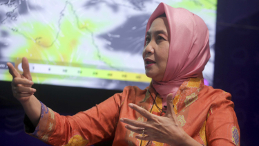
Jakarta – Head of the Meteorology, Climatology, and Geophysics Agency (BMKG), Dwikorita Karnawati, revealed that extreme weather in Indonesia could potentially persist until next week because the impact of three tropical cyclone seeds located in the Indian Ocean.
"Currently, there are cyclone seeds in the Indian Ocean that have the potential to cause high waves directly and indirectly lead to the formation of clouds resulting in rain or extreme weather," Karnawati said at the Parliament Complex Senayan, Jakarta, on Thursday.
Karnawati stated that this extreme weather is almost evenly distributed throughout Indonesia.
 Dwikorita Karnawati")
Kepala BMKG (Badan Meteorologi, Klimatologi, dan Geofisika) Dwikorita Karnawati
- VIVA/M Ali Wafa
Therefore, BMKG urged the public to still be careful and always check information from BMKG regarding the weather.
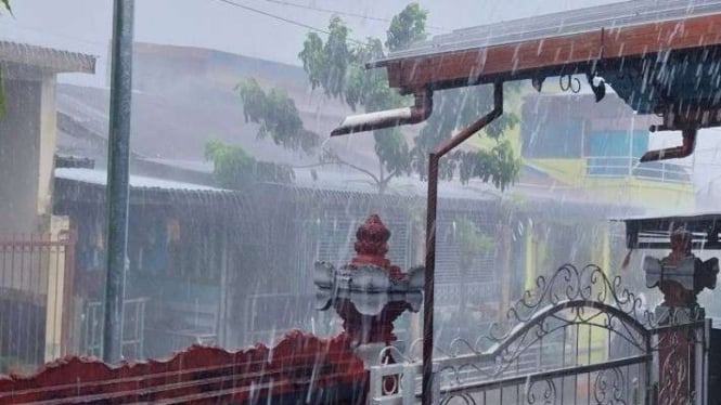
"In Indonesia, it's almost everywhere because this should be nearing the dry season but there's an increase in rainfall during the day and afternoon," Karnawati remarked.
Meanwhile, Deputy of Meteorology at BMKG, Guswanto, explained that although the potential for extreme weather exists throughout Indonesia, the areas under alert or severe conditions for the next week are East Nusa Tenggara, West Nusa Tenggara, South Kalimantan, and West Kalimantan.
Therefore, people in those areas need to increase their vigilance regarding extreme weather.
"For the next week, we predict alert conditions in West Nusa Tenggara, in Central Kalimantan, West Kalimantan, including East Nusa Tenggara" he remarked.
He also added: "This is because of the effects of 3 tropical cyclones, 91S, 93P, and 94S, which are currently located in the South Indian Ocean until the Arafura Sea,"
As quoted from the Instagram page @Infobmkg, tropical cyclone seed 91S was observed in the Southeast Indian Ocean, south of Java.
Maximum wind speeds of 25-35 knots and minimum air pressure of 997 hPa are moving southeast away from Indonesian territory.
The potential for Tropical Cyclone Seed 91S to grow into a tropical cyclone within the next 24 hours is categorized as Moderate-High.
Meanwhile, tropical cyclone seed 94S was observed emerging in the southern Timor Sea, southeast of East Nusa Tenggara.
Maximum wind speeds of 15-20 knots and minimum air pressure of 1,000 hPa are moving eastward.
The potential for Tropical Cyclone Seed 94S to grow into a tropical cyclone within the next 24 hours is categorized as Low.
Last, tropical cyclone seed 93P is still observed in the Carpentaria Gulf, northeastern Northern Australia, southeast of Papua.
Maximum wind speeds of 15-20 knots and minimum air pressure of 1,004 hPa are moving east to southeast.
The potential for Tropical Cyclone Seed 93P to grow into a tropical cyclone within the next 24 hours is categorized as Low.