Tropical Cyclone: Knowing Cause of Indonesian Extreme Weather

- NOAA
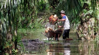
Jakarta – The Meteorology, Climatology, and Geophysics Agency (BMKG) has detected the emergence of three tropical cyclone seeds in the Indonesian region which could potentially cause extreme weather in several areas until early next week (March 14–18, 2024).
These are tropical cyclone seeds 91S, 94S, and 93P. All of them are located around the southern Indian Ocean near Java, Timor Sea, Australian Sea, and affecting the southern part of Indonesia.
BMKG predicts that the emergence of these three tropical cyclone seeds could increase the potential growth of rain clouds, wind speed, and wave heights in the vicinity of the tropical cyclone regions.
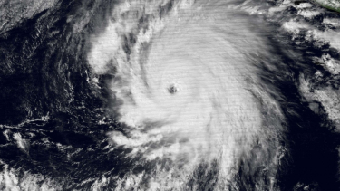
According to BMKG, a tropical cyclone is a large-scale storm with an average radius reaching 150 to 200 km.

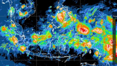
Ilustrasi BMKG mendeteksi dini potensi cuaca
- ANTARA/HO-BMKG
These storms form over vast oceans that generally have warm sea surface temperatures, more than 26.5 degrees Celsius.
Strong winds rotating near its center have wind speeds exceeding 63 km per hour.
Technically, a tropical cyclone is defined as a non-frontal low-pressure system of synoptic scale that grows over warm waters with convective disturbance areas and maximum wind speeds reaching at least 34 knots in more than half of the area surrounding its center, and lasting at least six hours.
The center of a tropical cyclone, called the eye, sometimes forms in areas with relatively low wind speeds and no clouds. The diameter of this eye varies from 10 to 100 km.
The eye is surrounded by an eyewall, a ring-shaped region that can reach a thickness of 16 km, which is the region where the highest wind speeds and largest rainfall occur.
Tropical cyclones typically last between 3 days to 18 days and will weaken or dissipate when they move into colder waters or land.
This is because the source of energy for tropical cyclones comes from warm oceans.
Tropical cyclones are also known by various other terms, namely "tropical storm" or "typhoon" or "hurricane" if formed in the Western Pacific Ocean, "cyclone" if formed around India or Australia, and "hurricane" if formed in the Atlantic Ocean.
The size of a tropical cyclone is calculated based on the diameter of the area experiencing gale force winds and varies in size from 50 km, as seen in Cyclone Tracy in 1977, to 1,100 km in Typhoon Tip in 1979.
Meanwhile, the maximum wind speed of a tropical cyclone is the highest 10-minute surface wind speed that occurs within the cyclone circulation.
The highest speed winds are usually found in the ring region near the center of the cyclone, or if the cyclone has an eye, they are found in the eyewall.
The tropical cyclone growth area can be divided into seven regions covering oceans worldwide, namely in the North Atlantic, Northeast Pacific, Northwest Pacific, North Indian, South Indian, Southeast Indian/Australian, and Southwest Pacific/Australian oceans.