BMKG Warns for Heavy Rains during 2024 Eid Homecoming

- VIVA/M Ali Wafa


Jakarta – Indonesian Head of the Meteorology, Climatology and Geophysics Agency (BMKG) Dwikorita Karnawati warned of the potential for extreme weather like heavy rain that will happen during Eid homecoming period, especially on April 4-11, 2024.
"Indonesia has potential for heavy rains and strong winds from April 4 to April 11, 2024," Karnawati said at a press conference in Jakarta, on Thursday.
She added that the potential for rain was caused by the Madden Julian Oscillation (MJO) phenomenon or a collection of rain clouds that had started to cross the islands of Indonesia.
The collection of rain clouds moved in procession from the east of Africa in the Indian Ocean along the equator and across the islands of Indonesia, also towards the Pacific Ocean.
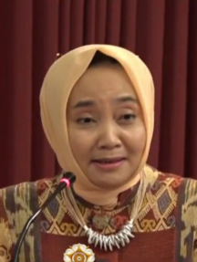
 Dwikorita Karnawati")
Kepala BMKG (Badan Meteorologi, Klimatologi, dan Geofisika) Dwikorita Karnawati
- VIVA/M Ali Wafa
Karnawati said that based results of detection and predictions a few days earlier, it was known that currently the procession of rain clouds was actually visible in Indonesia, especially in the western part and would head towards the center and ultimately to the east.
Apart from MJO, other phenomena that also cause moderate to heavy rain during the Eid homecoming are atmospheric wave phenomena, namely equatorial Kelvin and Rossby waves and warm water surface temperatures in the Indonesian Islands.
She remarked these two phenomena also play an important role in increasing the formation of rain clouds in the Indonesian Islands.
In fact, BMKG has just detected the emergence of a new Tropical Cyclone Seed, namely Cyclone Seed 96S which appeared around the Savu Sea and is currently at a position of 10.2 degrees South Latitude and 121 degrees East Longitude.
“Identified shows a tendency (Tropical Cyclone Seeds) will occur in the next few days. This is what was just detected this morning,"
This cyclone seed causes maximum wind speeds ranging from 16 to 20 knots or 28 to kilometers per hour with pressure at the center of around 1,007 millibars.
The cyclone spawn is moving southwest to south away from the southern waters of East Nusa Tenggara (NTT) towards Australia and in the next 24 to 48 hours has a low chance of becoming a Tropical Cyclone.
However, in the next 48 to 72 hours the Cyclone Seed has a medium to high chance of becoming a Tropical Cyclone with a movement direction southwest south away from Indonesian territory towards Australia.
The seeds of Cyclone 96S, which are currently still in NTT, can have a direct and indirect impact on weather conditions in several regions of Indonesia in the next 24-48 hours.
The impact is in the form of heavy rains in the areas of Bali, West Nusa Tenggara (NTB), and NTT as well as strong winds around East Java, Bali, NTB, and NTT.